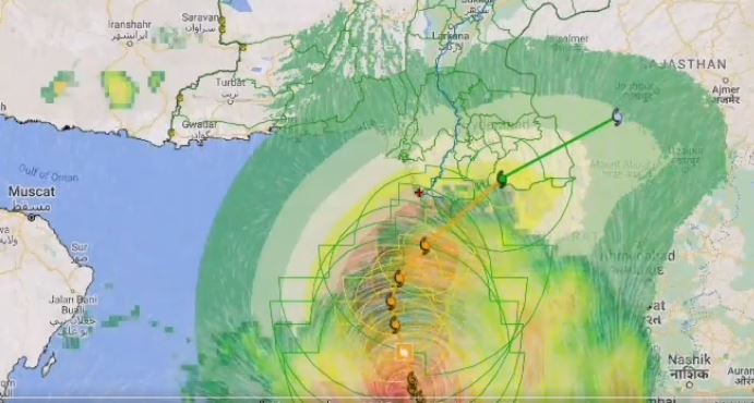
ISLAMABAD — The Tropical Cyclone ‘Biparjoy’ has weakened into a “Very Severe Cyclonic Storm” (VSCS)-Category 3, with sustained windspeeds of approximately 140-150 kilometers per hour (km/h) and gusts up to 170 km/h after it started reaching closer to the coastline of the country.
According to the National Disaster Management Authority (NDMA), the current location was near Latitude 20.7° N and Longitude 67.1° E, roughly 460 km south of Karachi and 450 km south of Thatta and 565km southeast of Ormara.
سمندر ی طوفان بائپرجوائے شدت میں کمی کیساتھ کراچی سے 440 کلومیٹر جبکہ ٹھٹھہ سے 430 کلومیٹر جنوب میں موجود ہے. طوفان کی پیشرفت اسکے ممکنہ اثرات کو مزید واضح کر یگی۔ محتاط رہیں محفوظ رہیں.https://t.co/TBWt0ziBw5#BiparjoyCyclone
Source: PDC, Zoom Earth, Windy pic.twitter.com/g0l7ONCvr5— NDMA PAKISTAN (@ndmapk) June 13, 2023
According to the latest forecast, tropical cyclone Biparjoy was expected to maintain a northward trajectory until the morning of June 14 and then it was likely to recurve eastward and would make landfall between Keti Bandar (Southeast Sindh Coastline) and the Indian Gujarat Coastline in the afternoon of June 15, as a Very Severe Cyclonic Storm (VSCS).
The areas likely to be affected included Thatta, Badin, Sajawal, Tharparkar, Karachi, Mirpurkhas, Umerkot, Hyderabad, Ormara, Tando Allah Yar Khan and Tando Mohammad Khan. These findings have been developed by the National Emergencies Operation Centre (NEOC) Technical team using international and national models (PMD-NWPM, NASA, PDC & UKM, IMD, BOM-A, and ECMWF).
SOURCE: APP

